A FEW DAYS IN DEATH VALLEY – ZABRISKIE POINT AND THE VALLEY BELOW
A FEW DAYS IN DEATH VALLEY
ZABRISKIE POINT AND THE VALLEY BELOW
By Charles N. Stevens
Photos by Dolores Seidman
After our tour to the Amargosa Opera House, we move on to Death Valley itself. On our way, the bus stops at the side of the road as men and machines are resurfacing it. While stopped, I peer out of my window at a single yellow flower on a long wire-thin stem rocking in the wind, tracing its small shadow over the gravel and dust. It is so simple yet beautiful, and I admire its existence in such harsh surroundings. The afternoon is sunny with a few clouds trying to exist in all that dryness.
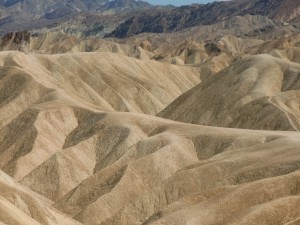
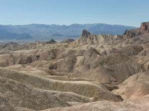
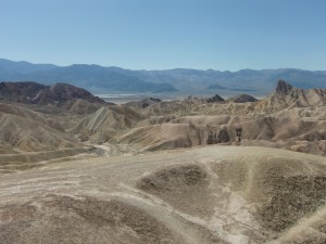
We arrive at Zabriskie Point, giving us a view of most of Death Valley. The vastness of it is overwhelming. It appears to swallow everything that enters it, reducing whatever it might be to nothingness in the immensity of the place. The sharp Panamint Mountains rise in the west, the highest peaks dappled with snow, and the Black Mountains are on its east. The floor of the valley is streaked with brilliant white salt flats, sunbaked brush land and sand dunes, all bordered by fluted beige foothills and twisted dark rocks resembling slag piles. Zabriskie Point itself is so unusual that it doesn’t look real. Sharp tan slopes and ridges are all around us. Words do not do it justice, only the photographs will bring out its fantastic reality.
Next on our tour is the Death Valley Visitor Center where we see a film depicting the valley in all seasons and all its features up close. Also in the center, we look at exhibits explaining the flora and fauna of the valley as well as the geology of its natural features and Indian life of the area. And it is cool inside, a relief from the 95 degree temperature outside. It is only April, but the valley warms up fast.
At the center we learned more facts about Death Valley. At its lowest point (Badwater Basin) the elevation is only 282 feet below sea level. The hottest temperature ever recorded in the world was 134 degrees, and that was reached at Furnace Creek in 1913. One Indian tribe, the Timbisha, actually lived in the area despite its harshness. The area was named Death Valley in 1848 when thirteen pioneers perished here on their way to the gold fields.
As lodging in Death Valley is quite expensive, and we are on a budget tour, we will travel to Beatty, Nevada for a reasonably-priced motel. The beautiful Furnace Creek Inn, which we see to our right, is a palm-studded oasis in a sea of aridness. It charges over five hundred dollars per night per room, including breakfast. But it is a wonderful place with its stone walkways amid palms, flowers and blue pools. They offer bike rentals, jeep tours and a grand golf course with green fairways and trees. And, how many people can say that they slept in a bed that was 215 feet below sea level?
As we pull in to the motel parking area, noisy grackles with their long tails and shiny black bodies flit among the dried-out fronds of the palm trees. Beatty, Nevada is a small town located on the Amargosa River and US Highway 95. Known at the eastern gateway to Death Valley, it is over 3,000 feet high. The Shoshone Indians hunted game and gathered wild plants here many years ago, but they were replaced by the miners hunting for gold in the nearby Bullfrog Mountains just west of Beatty. At one time Beatty was a railroad center, but now not a single rail is to be seen. The last railroad, the Tonopah and Tidewater, finally ceased operations in 1940.
Later, as the sun sets, we are treated to the iron-gray, sharp-edged silhouette of the nearby hills, a rosy glow behind them. Once it’s dark, a great chorus of tree frogs sings in the cottonwood-shrouded wash just outside our room.

Zabriskie Point, with its sharp beige hills, looks unreal.

In another direction , the hills look ragged and jumbled.

The view of far away Death Valley with its salt flats, brush land and dunes, is visible from Zabriskie Point.

The author and photographer take time out to pose at Zabriskie Point.
MONTEREY PARK AUTHOR PUBLISHES 4th BOOK – Seeking More of the Sky: Growing Up in the 1930’s:
Charles “Norm” Stevens, a 43 year resident of Monterey Park has recently published his 4th book: Seeking More of the Sky: Growing Up in the 1930’s. This is the story of a young boy growing up in Inglewood, California in the l930’s. This was a time during the depression when unemployment was affecting many and the banks were closed, while the clouds of war were gathering in Europe. But he was lucky enough to be raised in a loving family, the power of that love reflected throughout his stories.
Stevens is the author of three previous books about his experiences during WWII:
An Innocent at Polebrook: A Memoir of an 8th Air Force Bombardier (Story of his 34 bombing missions from his base at Polebrook, England over Germany and France)
The Innocent Cadet: Becoming A World War II Bombardier (A prequel to the first, telling of his training in the U.S. before going overseas into combat.)
Back from Combat: A WWII Bombardier Faces His Military Future from Combat: (This book details the time from when he returned from combat in England until the end of the war.)
He is known to the readers of The Citizen’s Voice as the author of Travel Log Articles including “Cruising the Rhine and Mosel”,” Best of the West”, “In Search of Snow” , “From Paris to Normandy on the Seine”, and “Exploring New York”. He is retired, having taught for 32 years, primarily in the Montebello Unified School District.
Those interested in purchasing an autographed copy of any of his books, may contact the author at 323-721-8230 or Normstevens24@gmail.com.


